WVDEP Geographic Information Server
The WVDEP Geographic Information Server provides location-based web services, applications, and data for agency personnel and the public.


Mapping applicationsThe DEP maintains custom web applications for both DEP personnel and the public. Some applications are designed as general exploratory tools organized around a particular type of data, often related to a particular permitting activity or DEP office. Other applications are designed to provide task-driven information quickly, without the need to start a desktop application or calculate an answer manually.
New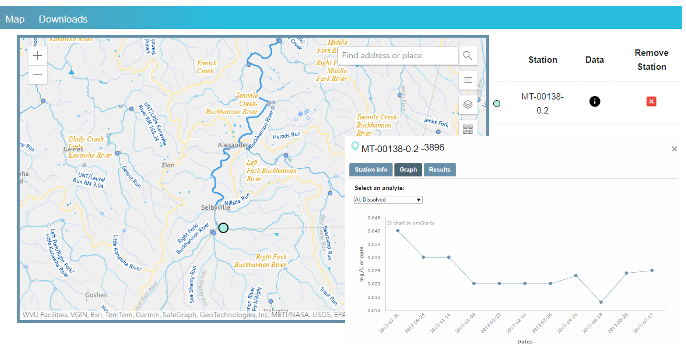 WAB sample database
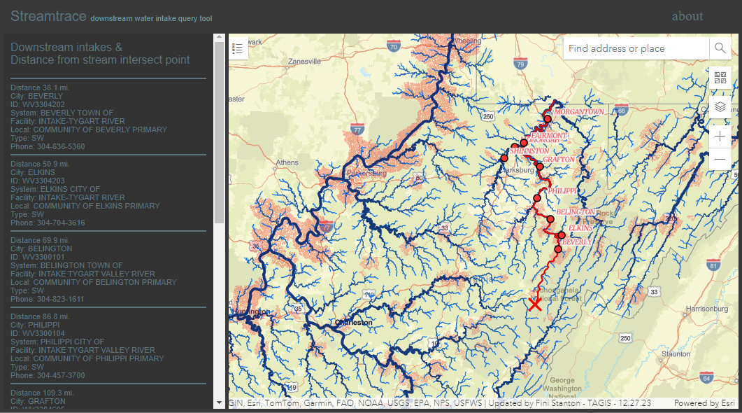 Stream trace
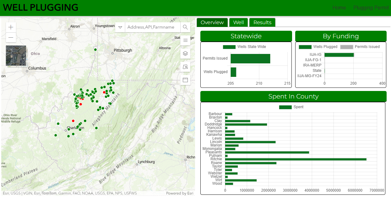 Well Plugging Activity
 Karst Feature explorer
Web services provide geographical data to a variety of clients, including desktop GIS software, mobile apps, and 3rd party web applications that run in a browser. Services are quickly becoming the preferred means of using and combining geographical information from multiple authoritative sources.
ArcGIS Portal is now available to support groups of users who wish publish their own data, create their own maps, and develop web/mobile applications to support the agency mission.
A 3d point cloud viewer lets anyone view 3d point cloud data from UAV mapping flights in a web browser using the free PoTree software.
